Online Mapping Tool Created by Missoula County Distinguishes Public Land, Trails and Parks Nearby
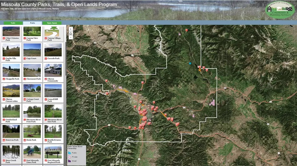
The Missoula County Parks, Trails & Open Lands Program has launched an new online mapping tool to help Missoulians discover new sites across town. Parks and Trails Coordinator John Stegmaier said this map makes it easier for the public to locate specific trails or parks nearby.
"We created a program on a website to help people find county parks and trails as well as lands protected under conservation easements," Stegmaier said. "Right now, we are really blessed in our area to have a lot of public land. One thing that people struggle with is distinguishing which land is managed by what particular agency."
Stegmaier said a lot of times folks are unaware of county parks and trails and this new online map he hopes will help that distinction.
"We collected the data and went out for our trails as a staff and recorded GPS tracks of all of our trails so we would know exactly how long they were," Stegmaier said. "What we tried to do was put all of our data for our parks with an image and a little bit of information about accessing that, what amenities might be there, and then plugged that into a really easy interface that works well with your phone, or a tablet, or your desktop computer."
Stegmaier said an intern at the University of Montana assisted the mapping program by working with data management and content entry into the application.
"County Geographic Information Systems staff were then able to take this data and work through the technical implementation challenges without the need to hire outside consultants," Stegmaier said.
Click here to view the map.
More From Newstalk KGVO 1290 AM & 98.3 FM
