DON’T Be Here During a Powerful Montana Quake
Even scientists don't know where all of Montana's earthquake faults are.
And they've told me in the past that's largely because there's been limited funding in the past to thoroughly map and study every crack, and the potential for quakes.
But now, thanks to the latest technology, we know the one spot in Montana you don't want to find yourself if there's a major earthquake.

Blame Yellowstone
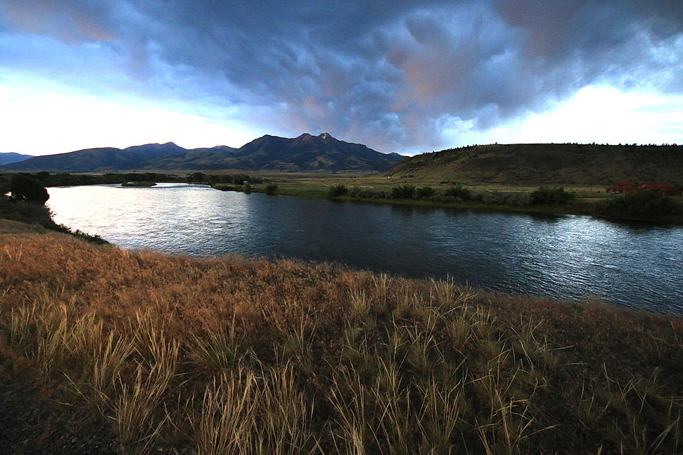
The Yellowstone Caldera is one of the earth's major sources of geological disruption, with its "supervolcano" status, and the associated quake zones that spread across the Greater Yellowstone region. And because of that, it is one of the most studied features in North America.
It was that combination that turned deadly in 1959 when the 7.3 magnitude "Madison Quake", sometimes called the Hebgen Lake Earthquake, created a massive landslide, which swept down the mountainside. Some estimates have said the slide moved at 100 miles per hour, sending 80 million tons of rock into the canyon in less than a minute, trapping a few hundred people and killing 28 people, many in a campground below the slide.
At the time it was the largest quake ever recorded in the Continental U.S.
Could it happen again?
Regional seismologists have always talked about the possibility. And now, new radar-based findings have confirmed that suspicion.
This week, the U.S. Geological Survey posted a report from the Yellowstone Volcano Observatory which shows the area extending north from Yellowstone through the Paradise Valley has been a hot spot for quakes and big slides for millennia.
The data is based on an analysis of Lidar images. These Light Emitting Detection and Ranging images look deeper than vegetation allows and have revealed what researchers say is evidence of "numerous landslides of gigantic proportions".
The report says there is an "expansive and complex distribution" of earthquake scarps for more than 30 miles, extending from Tom Miner Creek Road north to Livingston. The researchers say this is evidence of the ground "rupturing" from large earthquakes of magnitude 6.5 or greater.
One image shows a prehistoric slide that was large enough to fill Yankee Jim Canyon. One section of the Emigrant fault near the mouth of the canyon shows the "alluvial fan" deposits on the lower slopes which built up over the remnants of the massive slides.
That location is at Carbella, which is also the site of a campground.
Images could help save lives
Scientists say that evidence of a "cascading" natural disaster is just like what happened on the Upper Madison River in 1959 and "provides an example that could happen if a large earthquake were to occur in the Paradise Valley."
The Montana Bureau of Mines and Geology plans to use the new images as part of a statewide update of the statewide fault maps and database, and the info could help Park County generate hazard maps, which take on extra importance given the population growth in the Paradise Valley over the past 30-years.
Montana's Top 10 Record-Setting Wild Weather Events
Gallery Credit: Brian Lee
More From Newstalk KGVO 1290 AM & 98.3 FM


![Missing Victor Man Found – Investigation Underway [AUDIO]](http://townsquare.media/site/119/files/2013/07/David-Kaiser-resized.jpg?w=980&q=75)
